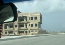
The Nasarawa Geographic Information Service (NAGIS) is to map out land for the proposed mass housing scheme of the federal government.
Media aide to Governor Umaru Tanko Almakura, Ahmed Tukur, made this known on Tuesday in Lafia said that NAGIS will be engaged to work out the master plan for the land after the aerial survey of the proposed area to make it easy for the federal government to commence work immediately.
He said after the Governor took an aerial survey of the proposed lands around Mararaba in Karu local government, he said the state government will give federal government all the necessary support and assistance to ensure the success of the project.
He said Governor Al-Makura, who made the disclosure during a meeting with the management of Nasarawa Geographical Information Service (NAGIS) in their office in Mararaba area of Karu local government, added that the rapid population growth around the area necessitated the construction of a robust housing scheme.
‘‘Al-Makura said that the state government will collaborate with the federal government and identify lands suitable for the federal government mass housing project and contact the federal ministry of power, works and housing,’’ Tukur said.
This move was sequel to demand by the minister of power, works and housing, Babatunde Raji Fashola, that the state government make available land for the housing scheme.


NAGIS to Delineate Land for FG’s Proposed Mass Housing Scheme: The Nasarawa Geographic Information Service (NA… https://t.co/SQSZZBMRIl